Keep up with our latest news and projects!
While moving around the city we either move with intent or we meander, walking around aimlessly. We do so by following a certain reading of our surroundings. This reading has been dubbed as wayfi nding. Wayfinding is not an isolated activity, but a piece of the urban puzzle. Signage, the defacto solution for wayfi nding in the built environment, is an even more abstracted form of that activity. Through signage, we expect to abstract the city and all its plinths into a predetermined set of destinations or landmarks, which we assume are the main destinations any one person would need to go to in this particular city. Then we map them through a series of breadcrumb signs that are strategically placed at nodes and intersections allowing us to make the decision to go left, right or forward—or to retract our steps if we’ve lost our way. Nevertheless, our experience of the city, our experience of a plinth, is not through a preset system of signs, nor is it through reading a map, or even reading a tourist book if we are visiting the city for the fi rst time. Our experience of the city is what happens in between, the moments along the way.
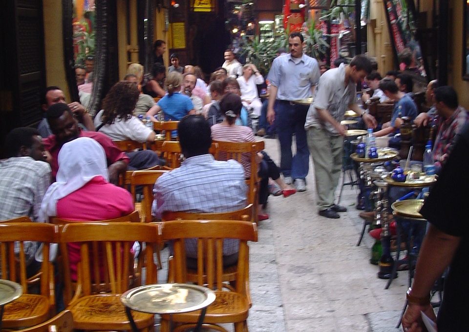 Cairo, Khan el Khalili
These in-between experiences occur from the reliance of our memory on spaces and places, sequences and hierarchies that we’ve grown accustomed to. We can only decipher something by using preconceived notions by comparing that thing to something similar we’ve encountered before. We don’t all have similar backgrounds and similar memories of places, and the places themselves don’t have similar stories and characters. The memory of the city stems from the memory of its users, its inhabitants whether they are inhabitants for a day or for a lifetime. The blending of those memories is what creates places with unique poetics.
The landmark is a secondary wayfinding cue in that city. When we look at the Haussmanian breakthrough which does the same on a much grander scale, it has transformed Paris into boulevards which connect its landmarks, with experiences taking you from one to the next, with activations along the way. The design allows you to form a clear cognitive reading of the city at eye level, navigating you through its streets in an intuitive manner and helping you to build a memory of it. Therefore anywhere we head to a new place, it unravels itself to our eyes through the same lens we have learned to read our city and its street level. Nevertheless not all cities are gridded or pierced, so in the distinctive manner from our culture, we perceive and decipher places through the cognitive method and landmarking we uniquely understand.
We perceive the surrounding through our cone of vision which allows us to navigate and understand what is around us. It is through this cone that we connect with the other and the built environment especially the plinth of the street level. But the cone of vision differs from one culture to the next. For example westerners walk looking at a point on the ground that is approximately 2 meters away and that defi nes the cone of perception through which we absorb what is around us.
But when walking around in Chinese cities (this also applies to other places I’ve travelled such as Japan, India, Egypt, and Africa) I have noticed that either people walk around looking straight down in front of them to make sure they avoid obstacles and thus completely missing the reading of the vertical built environment beyond that level, or people walk looking straight ahead and gauging obstacles by the way other people in front of them are moving and thus having a wider cone of vision but a lesser perception since it is obstructed by heads and raised towards the distance.
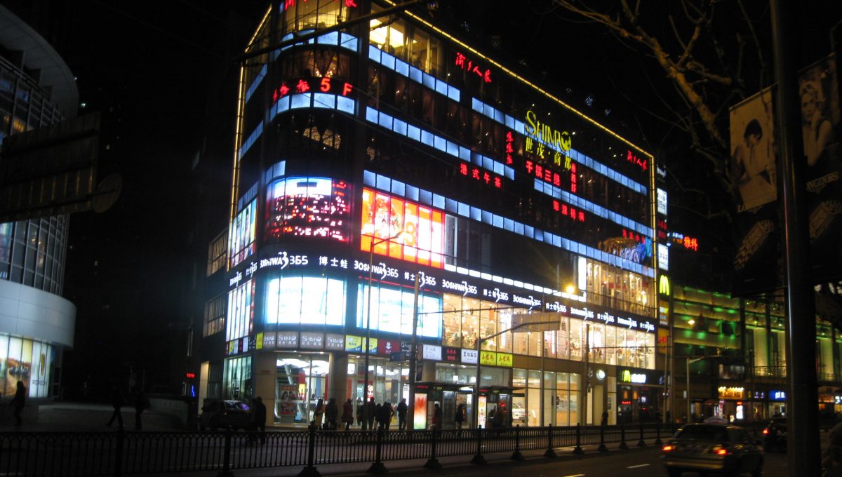
 Shanghai, Old Street
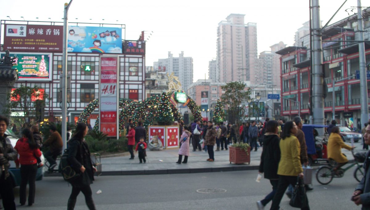
 Shanghai, People’s Square
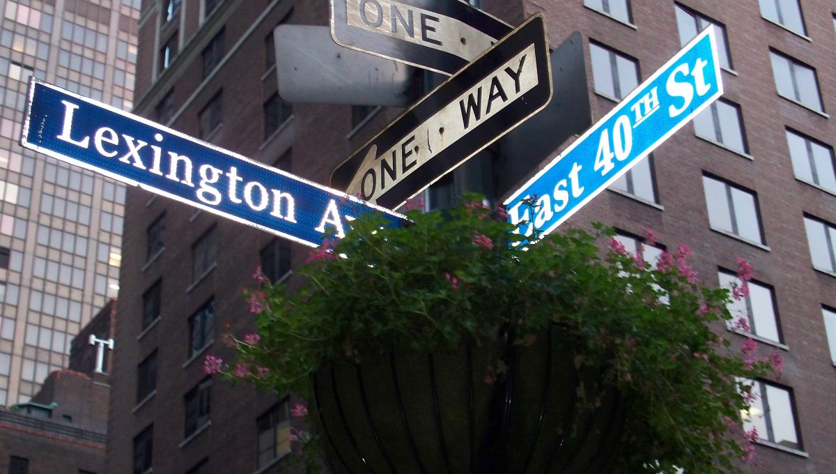 New York, intersection Lexington Ave and 40th Str
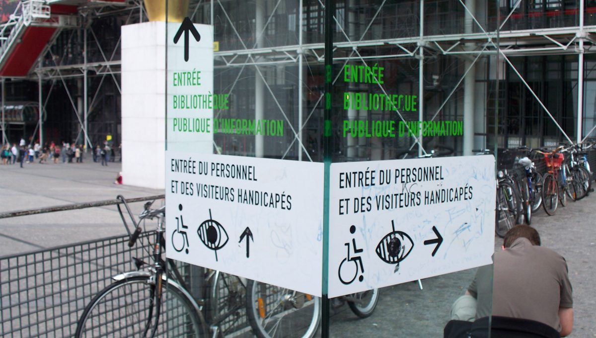 Paris, Centre Pompidou
The reading of the plinth becomes even more important in that case in order to find your way and read our surrounding environment. Building name signage, identification poles, and large scale numbers are more and more necessary to identify one building from the next. Yet the more we add information the more the visual clutter is undecipherable. Signage is not a way to solve the wayfinding problematics of the city as it is quite an abstraction of the city fabric. It only works as a reinforcement of the user’s circulation efforts. In order for circulation and directional signage to be effective the user has to fi rst know where they are going in order to be able to fi nd the trail of breadcrumbs left as guidance. If the user is lost it will not be signage that helps but a multitude of elements in the plinth that would help identify the location, identify the destination in relation to the location and then to gauge the best route to get there. Traditionally you would need a combination of landmarks, street name plaques, building numbering and street map, as they allow us to determine where we are, where we are going, how to head further, and if we are moving in the right direction.
Building typologies are also a great wayfinding cue in the city as they act as identification and landmark. But designers and developers seem to think that buildings have to take on more and more unusual shapes in order to be a billboard and landmark that stands out from the crowd of buildings. Yet since when we are at ground level, we do not perceive the entire building: it does not fi t within our cone of vision or we avoid looking at it if it is highly illuminated.
Nevertheless here is where cultural differentiation comes into major play. Even when a signage programme exists or is being designed in a certain location and environments the cues, the language, the conventions, and the perceptions all differ from one place to another, making it a more effective tool if designed properly for the locals but not for the visitors and foreigners (which is ironic since wayfi nding systems need to accommodate both the first time visitors as well as the seasoned user). When working with a multinational team on a wayfinding project we even encountered differences in perceptions to norms that are taken for granted by designers and architects coming from the west. A question as simple as which street to identify on which side of a cross intersection stemmed so much debate it took studies into regulations and standards to make a decision which would work in the location we were designing for and won’t go against the logic of traffic circulation that that specific culture is used to.
Interested? Join The City At Eye Level and share your story!
Discover moreTaking all the aforementioned criteria and restrictions into consideration when we are designing the plinth and the street level of the city, the fi rst thing we need to do is design its interface, the place where it interacts with its user. The city interface is what transforms it from being a structure into being a living ecosystem beating to the rhythm of its own poetics. The city or urban interface should be different from one place to another as it stems from the user experience of that culture and its way of perceiving their places and spaces. The interface is what allows these users to rely on their perceptions, their memories, their understandings and their cognitive maps to move around and navigate through the built environment.
We should not approach designing plinths for a city the same way we have done for another. We need to study the way people interact with each other and with their city, how they read and decipher its built environment and through which tangible cues like building typology, wayfi nding systems, language and street structure and through intangible cues like memory, culture, education and tradition in order to build up knowledge and design cities that retain unique.